City of Buffalo - Neighborhoods
For more information about the process of determining neighborhood boundaries, please refer to the Bibliography. This map is a completed project from a retired UB librarian.
- General Information
- Neighborhoods Map (interactive full-size)
- List of Neighborhoods
- Map Key
- Bibliography
- Related Sites
General Information
Welcome to the city of Buffalo Neighborhoods Map. The "City of good neighbors" consists of thirty-two neighborhoods varying in size, function, and historic significance. These current neighborhoods are described by location within the city, community associations, and cultural and ethnic history. Additional features of this page include links to related sites and a selected bibliography of source materials used in compiling the Neighborhoods Map website.
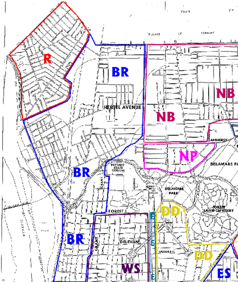
Northwest Corner
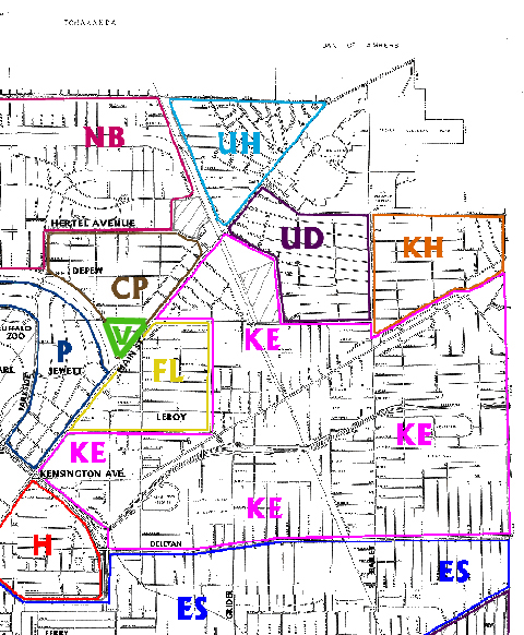
Northeast Corner

Middle Left
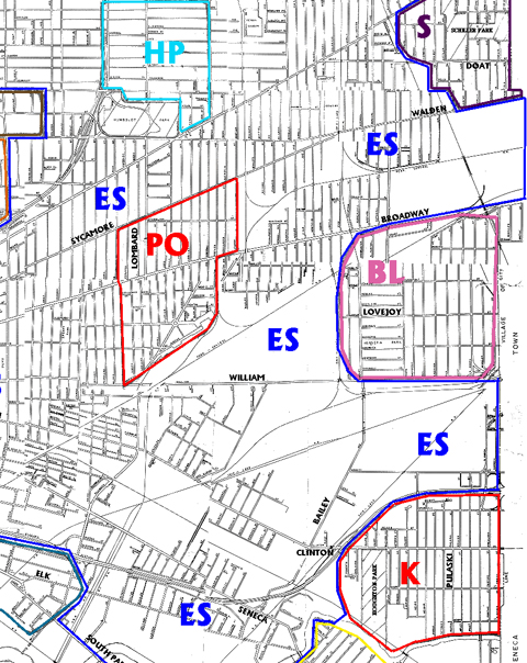
Middle Right
Southwest Corner
Southeast Corner
List of Buffalo Neighborhoods
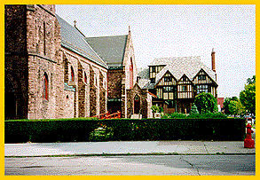
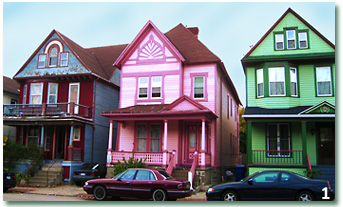 Many representative styles of architecture appear with a variety and flavor that is common in this neighborhood.

 Railroad tracks looking towards Central Terminal
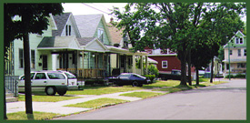
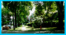
 These are views of typical streets in this neighborhood. Mature trees form shady streets.
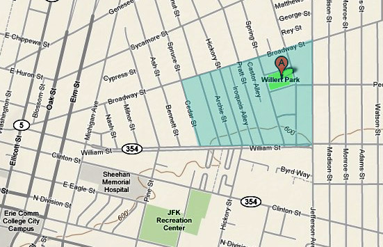
 The Bailey-Lovejoy area is a neighborhood near the boundary with the suburban town of
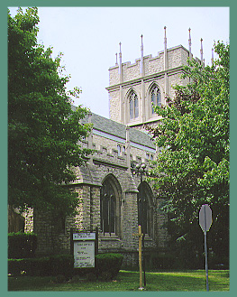
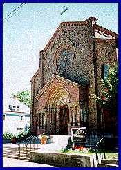
 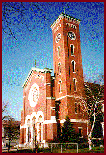 St. Francis Xavier R.C. Church (1911-1913) - 157 East Streetm - Max G. Beierl, architect
 Hertel Avenue east of Elmwood Avenue.
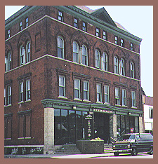
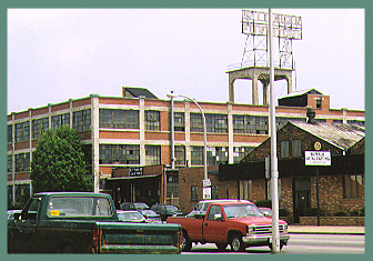 Former Kittinger Furniture building.
 Central Park 2002 (1:8,500 scale satellite image, based on Erie County GIS Office, GIS)
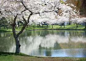 Forest Lawn Cemetery (1850) - Mirror Lake
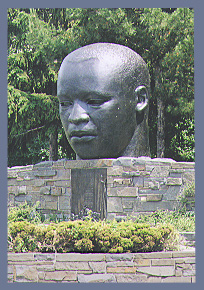
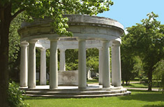 Birge Memorial on Mirror Lake shore

 Also in the Delaware District is the
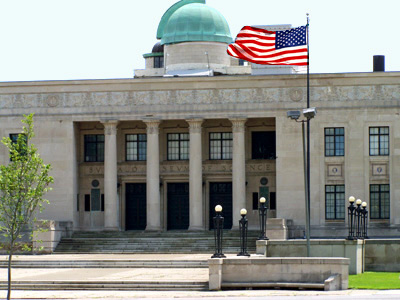
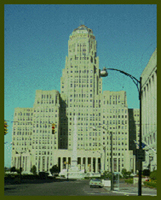 Buffalo City Hall (1929-1931) - 65 Niagara Square - Dietel, Wade & Jones, architects
 Prudential Building (1895-1896) - 28 Church Street - Louis Sullivan & Dankmar Adler, architects
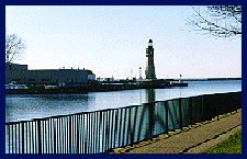 Buffalo Lighthouse (1833) - Fuhrmann Blvd. - U.S. Coast Guard Base
 Coles Restaurant - 1104 Elmwood Avenue
 Elmwood Avenue at Bidwell Parkway
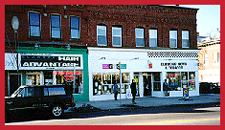 Elmwood Avenue shops
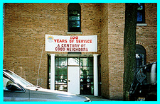
 Fillmore-Leroy Area Residents Community Center - 307 Leroy Avenue
 Blessed Trinity - 323 Leroy Avenue
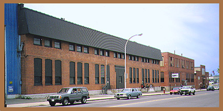
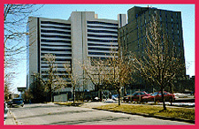
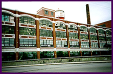 Former Trico Plant #2 - 2495 Main Street
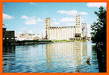 Buffalo River Grain Elevator
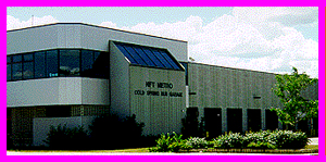
 Community Center
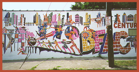
 The Futures Academy, Buffalo PS No.37 (295 Carlton), is part of this progressive East Side neighborhood.
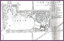 The Parade (1868) - Olmsted, Vaux & Co., landscape architects
 North Parade Street
 Clinton Street shops
 Houghton Park
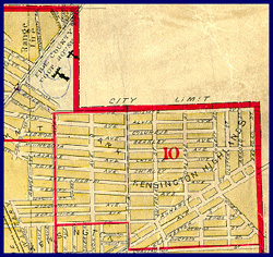
 Intersection of Kensington - Bailey Avenues
 Kensington residential area
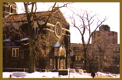
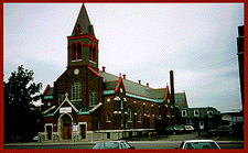 Holy Cross Catholic Church
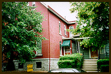 Home on Fargo Avenue
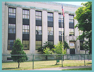
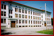 City Honors School - Masten & E. North Streets
 Buffalo Civic Stadium, circa 1939 - (War Memorial Stadium)
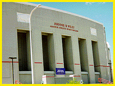 Wiley Sports Facility - Site of the old War Memorial Stadium
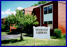 Woodson Gardens townhouses - Masten Place and North Street
 Fire Station on Colvin Avenue
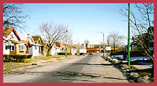
 Homes on Norwalk Street
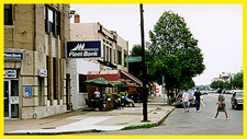 Hertel Avenue commercial district
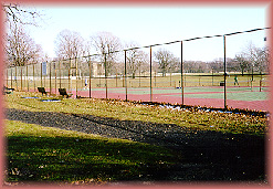 Delaware Park Tennis Courts
 Gardener's Cottage (1905) - 285 Woodward Avenue
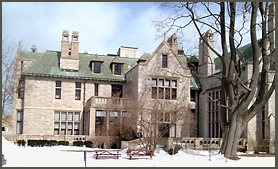
 Darwin D. Martin House (1904-1906), 125 Jewett Parkway - Frank Lloyd Wright, architect - (photo credit: NYS Parks & Recreation)
 Crescent Avenue is a typical street in Parkside
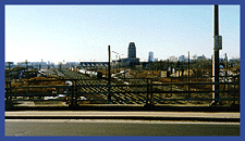
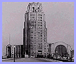 Central Terminal circa 1929
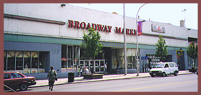 Broadway Market
 Polish Community Center of Buffalo Inc. - 1081 Broadway
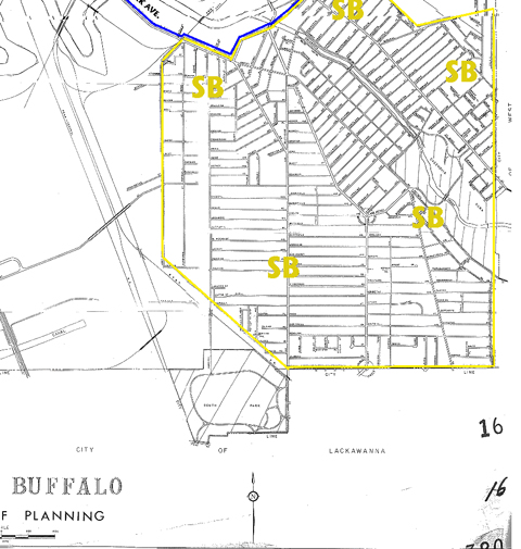
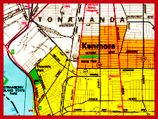 Map detail of Riverside Area - (N.Y.State Dept.of Transportation - Map of Erie County, 1990, scale 1:75,000)
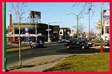
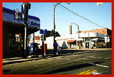 Intersection at Tonawanda and Ontario Streets
 A view along the Niagara Expressway
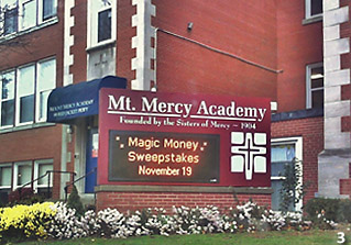
 Villa Maria Academy - 600 Doat Avenue
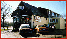 Scharf Schiller Park Restaurant - 34 South Crosman Boulevard
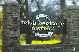 South Buffalo has a strong Irish-American presence.
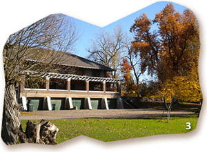 Cazenovia Park

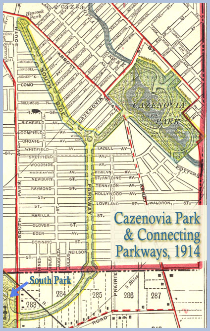 Plan of Cazenovia Park, 1896 - Olmsted, Olmsted & Eliot, landscape architects
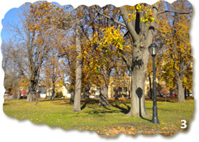
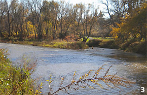 Cazenovia Creek runs through the park
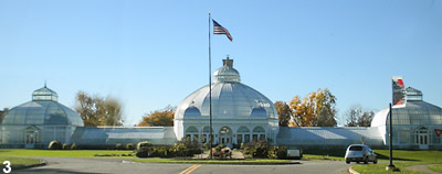 Buffalo & Erie County Botanical Gardens
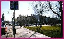
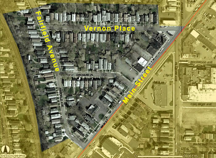
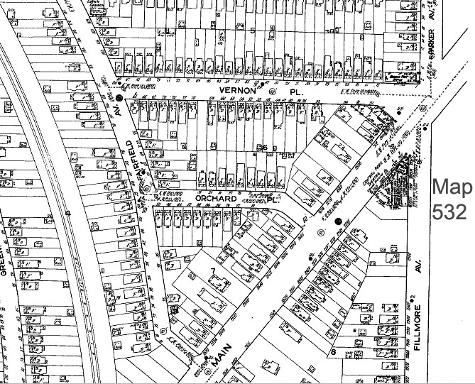
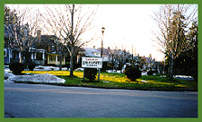 University Heights Welcome
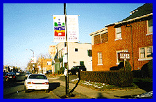 Main Street
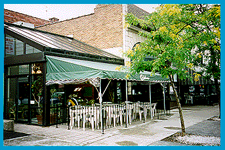
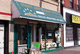 Street Café
 Halal Foods (adjoining the Street Café
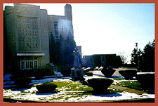
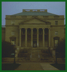
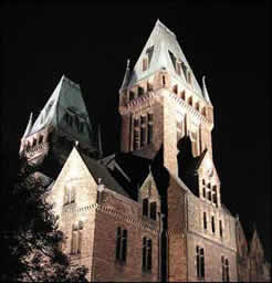
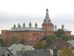
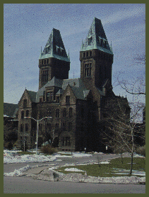 Buffalo Psychiatric Center (1870-1896) (formerly Buffalo State Hospital), Henry Hobson Richardson, architect - (photo credit: UB Dept. of Art History Visual Resources)
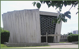
 Sketch of Kleinhans Music Hall (1938-1940), Symphony Circle, Eliel & Eero Saarinen, F.J. & W.A. Kidd, architects - Charles C. Potwin, acoustical consultant - (photo credit: UB's Dept. of Art History Visual Resources)
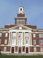 Grover Cleveland High School
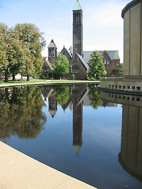 Kleinhans Music Hall & Symphony Circle
 Annunciation Roman Catholic Church - 18 Greenwood Place
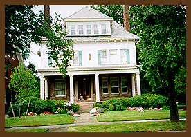
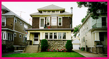
 Home on Norwood Avenue
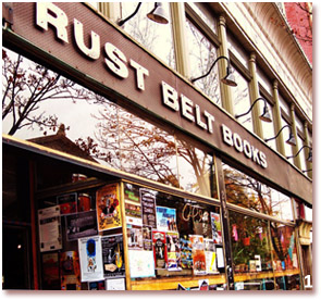
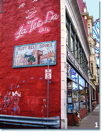
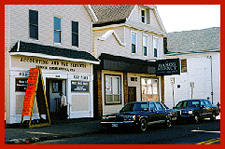
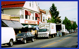 Guercio's Market, 250 Grant Street - On Grant Street, Guercio's Market and John's Italian Village Restaurant are traditional meeting places.
This page is updated regularly and will include neighborhood boundaries, more photos, more links, and additional data.
If you live in a neighborhood and have photos or other materials that you can share, we would be willing to consider them for addition to this site (credit for photos will be given).
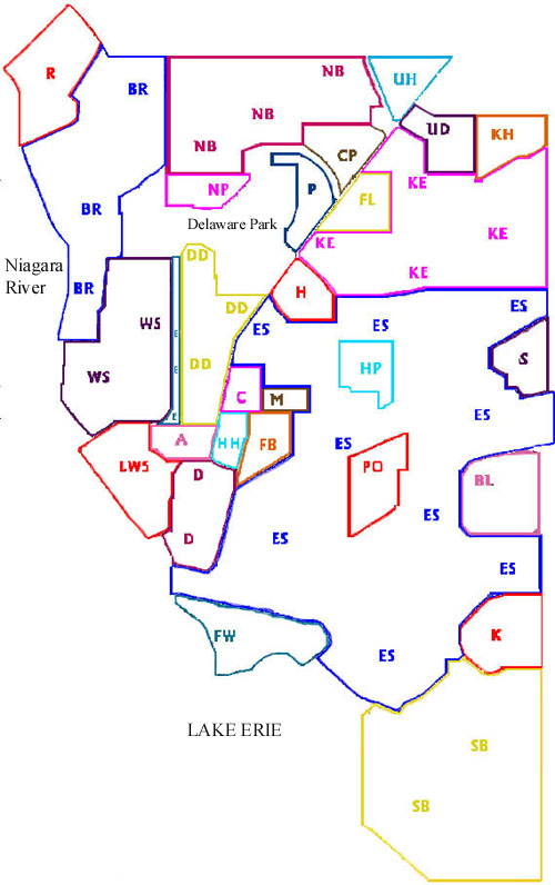
Map KEY
Bibliography
The following sources were consulted in creating this website:
- American Atlas Company. Atlas of the City of Buffalo, New York. (NY: American Atlas Company, 1894 [i.e. 1895])
- Beveridge, Charles E. The Master List of Design Projects of the Olmsted
Firm, 1857-1950. (Washington, DC: National Association for Olmsted Parks in conjunction with the Massachusetts Association for Olmsted Parks, c.1987) - Buffalo Architecture: a guide. (Cambridge, MA: MIT Press, c.1981)
- Cram, George F. Company. A descriptive review of the commercial,
industrial, agricultural, historical development of the state of
New York, with special charts, detail maps and profuse half tone
illustrations from all parts of the Empire state. (Chicago, NY: G.F. Cram, [c.1914]) - Geological Survey (US). Buffalo quadrangle, New York. (Map). (Washington, DC: The Survey, 1948).
- Geological Survey (US). New York. Erie County. Buffalo Quadrangle. (Map). (Washington, DC: The Survey, 1901).
- Goldman, Mark. City on the Lake: the challenge of change in Buffalo,
New York. (Buffalo, NY: Prometheus Books, 1990). - Goldman, Mark. High Hopes: the rise and decline of Buffalo, New York. (Albany, NY: State University of New York Press, c.1983)
- Kowsky, Francis R., editor. The Best Planned City: the Olmsted legacy
in Buffalo. (Buffalo, NY: Buffalo State College Foundation, 1991) - The National Register of Historic Places. (Washington, DC: National Parks Service, 1969- )
- Simon, Jacqueline C. "Changes in the residential neighborhood Parkside,
Buffalo, NY, 1925-1950." (Master's Thesis, SUNY University at Buffalo, 1989)
In addition, materials produced in English 201 (M.E. Schindler) are being incorporated into neighborhood pages from course projects (2010- ). Students are credited on pages relating to their project contributions.
Related Sites
Buffalo, New York Metropolitan Area
- Buffalo in Maps. Maps, charts, aerial photos, GIS, and other map resources at UB and on the Internet.
- Buffalo Public Schools. Complete listing of schools, addresses, programs, photos, and other information.
- Buffalo Catholic Schools (WNY Catholic Schools website). Search for schools in the region.
- City of Buffalo Official Website.
- Churches in Buffalo. Beautiful photographs of many (very many) churches in the Buffalo area. Search by name.
- Schools of Buffalo. By the author/photographer of the Churches in Buffalo site (above). Beautiful photographs of many (very many) schools in the Buffalo area. Search by name.
- Forgotten Buffalo. Great emphasis on Buffalo Neighborhoods and their history. Provides tour info and stories, etc.
- History of the City of Buffalo and Erie County: with Illustrations and Biographical Sketches of Some of its Prominent Men and Pioneers, in Two Volumes. Edited by H. Perry Smith. Syracuse, NY: D. Mason & Co., Publishers, 1884. Online facsimile of the book.
- Our Buffalo. Graphic map showing some of the neighborhoods.
- List of Street Name Changes in Buffalo. Brief listing of old names and new names.
- 1894 City of Buffalo Atlas. Property maps of the city. Full-color digital version of the original maps with good resolution (may not work with all browsers).
- UB Regional Institute. Resources on city development and activity.
Buffalo Parks, Olmsted Works and Activities
- Buffalo Parks System Map, 1914. Shows Olmsted's designs.
- Olmsted Parks in Buffalo, New York
- Cazenovia Park
- Delaware Park
- Front Park
- Riverside Park
- Parkways: Lincoln, Bidwell, Chapin, Richmond, Porter, Red Jacket, McKinley.
- Circles: Soldiers, Gates, Colonial, Ferry, Symphony, McClellan, McKinley.
- Preservation Buffalo Niagara (PBN) dedicated to fostering historic preservation in the Buffalo Niagara region, serving seven counties in Western New York.
Other Great Buffalo Neighborhood-Related Sites
- Buffalo as an Architectural Museum. Lists websites of existing buildings in Metro Buffalo, including Erie and Niagara Counties in New York State. Has many illustrations and photos.
- Buffalo, New York History. Photographs, drawings, maps, articles; wide variety of topics.
- Buffalo Spree magazine. Includes articles and resources on neighborhood activities, history, and culture.
- Guide to Buffalo English. Partly entertaining, this page does provide a good summary of the "accent" of Buffalonians.
- Erie Canal website. The Canal had a big part to play in Buffalo history and the old route is now covered beneath the city along the Niagara River.
- Visit Buffalo/Niagara page. Information and data on variety of Buffalo area sights and neighborhood activities.
- Tifft Nature Preserve. Just beyond the Buffalo boundaries but an important site in the effort to revive the city.
Buffalo and Western New York Region
- Buffalo–Niagara Falls Metropolitan Area (Wikipedia). Links to data and text on towns and villages in Erie and Niagara Counties.
- WNY Maps. UB Map Collection maps, charts, aerial and satellite photos, and online maps of Western New York, including Erie, Niagara, and other local counties.
Boston, Massachusetts
- Boston: A City of Neighborhoods. From full city map, click on each neighborhood to obtain a specific map.
Albany, New York
- Albany's Neighborhoods (City of Albany, NY).