Thematic Maps
Thematic maps describe a specific topic, or theme. The Map Collection includes thematic maps for all parts of the world. Types of thematic maps include geologic, nautical, ethnolinguistic, water resources, landforms, and population. For Western New York, thematic maps provide comprehensive coverage of geology, wetlands, recreation, historical plans, land use, soils, and nautical charts. To find a particular thematic map, use the UB Libraries catalog to retrieve its call number, and then use the floor plan to find that call number in the map cases.
Geological Maps
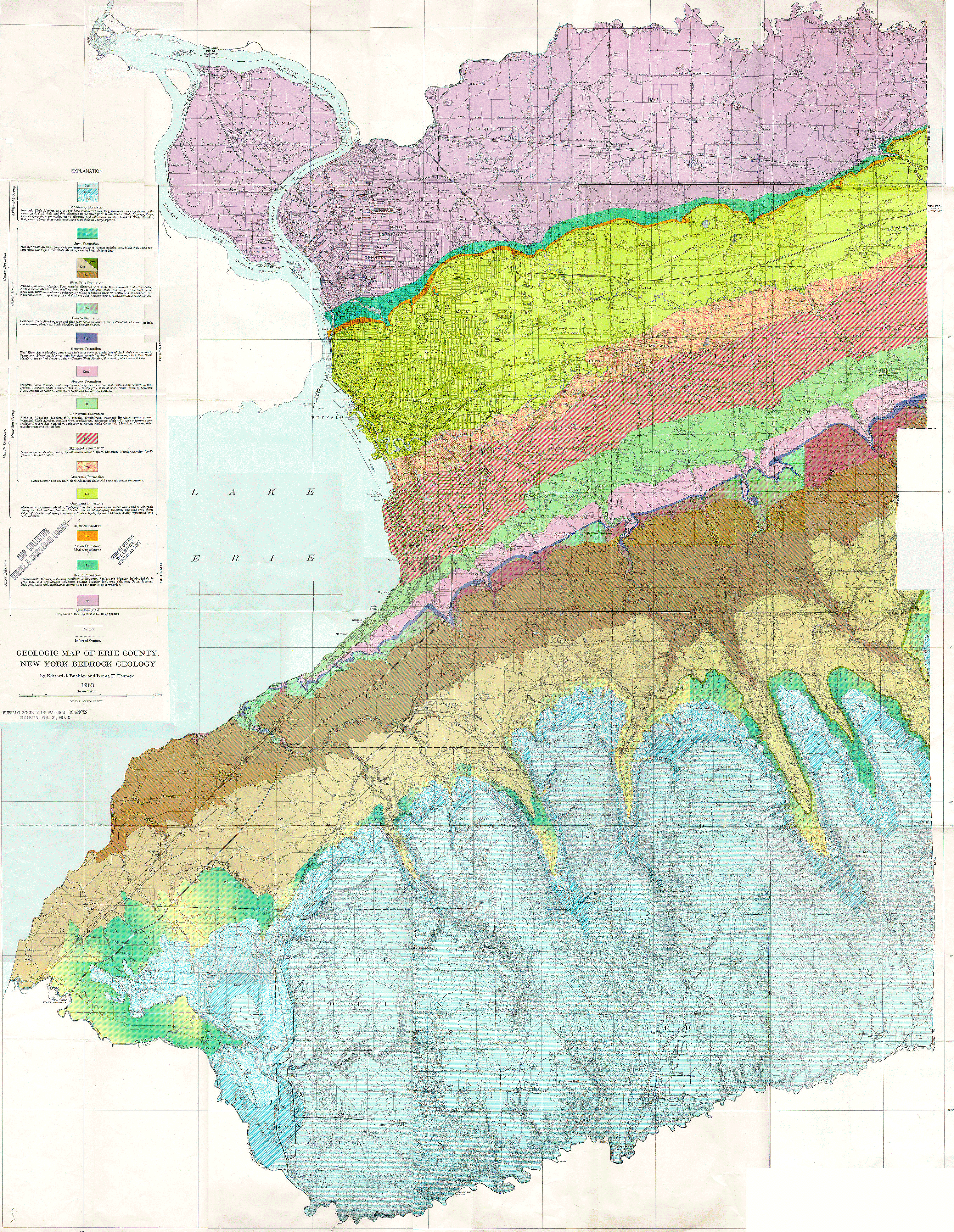 1:62,500 geological map of Erie County, Western New York.
 (6258K GIF image)
Call Number: QH1 .B94 v. 21 no. 3
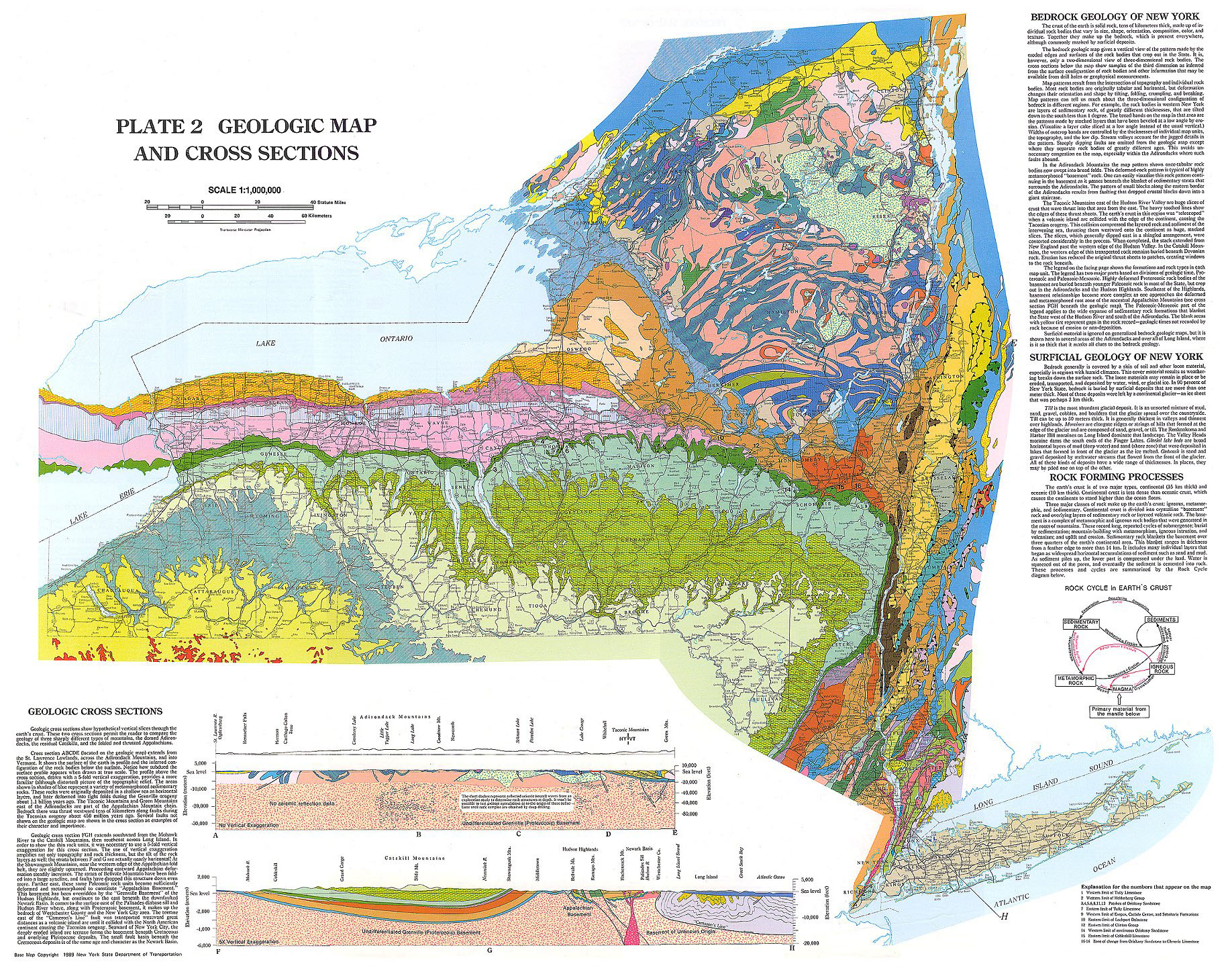 1:1,000,000 scale geological map of New York State
 1:550,000 Snow Survey Data map of Colorado
Climate or Soil Maps
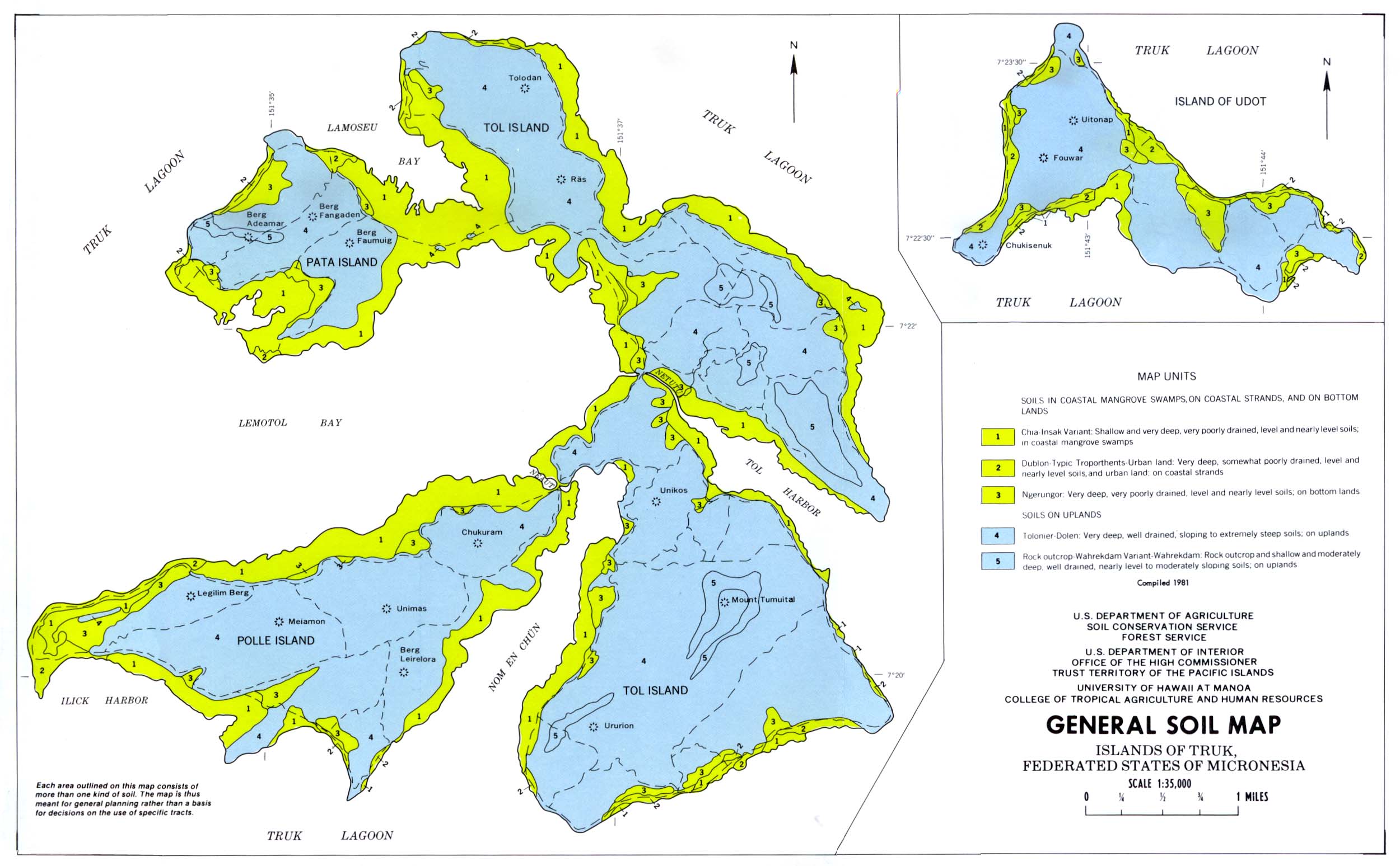 General Soil Map, Islands of Truk. (Thematic map at the University of Texas, Austin).
Maps of other Micronesian islands are here as well.
Political Maps
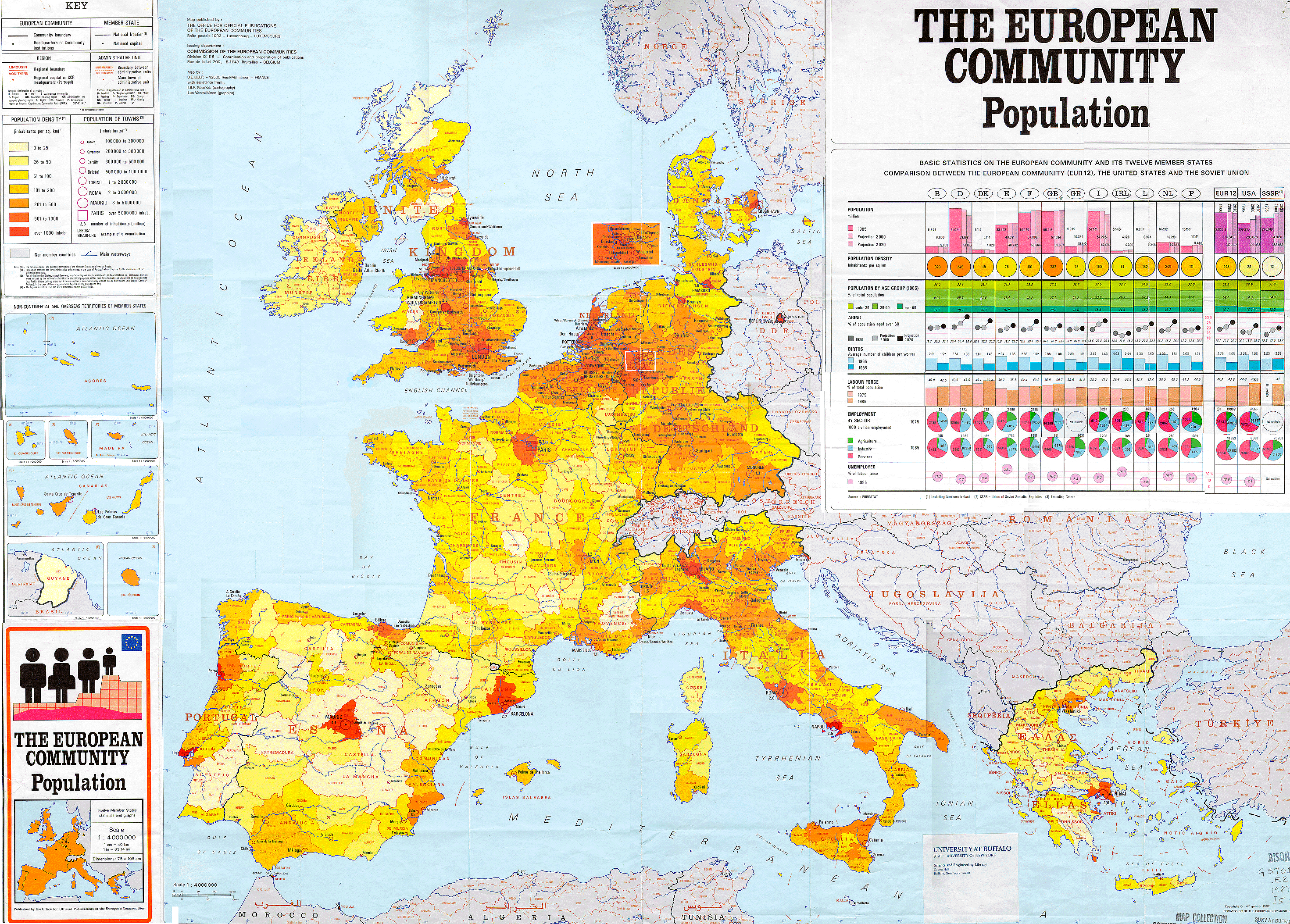 1:4,000,000 political map of Europe.
(3252KB GIF image)
1:4,000,000 political map of Europe.
(3252KB GIF image) Call Number: G5701.E2 1987 I5
Tectonic Maps
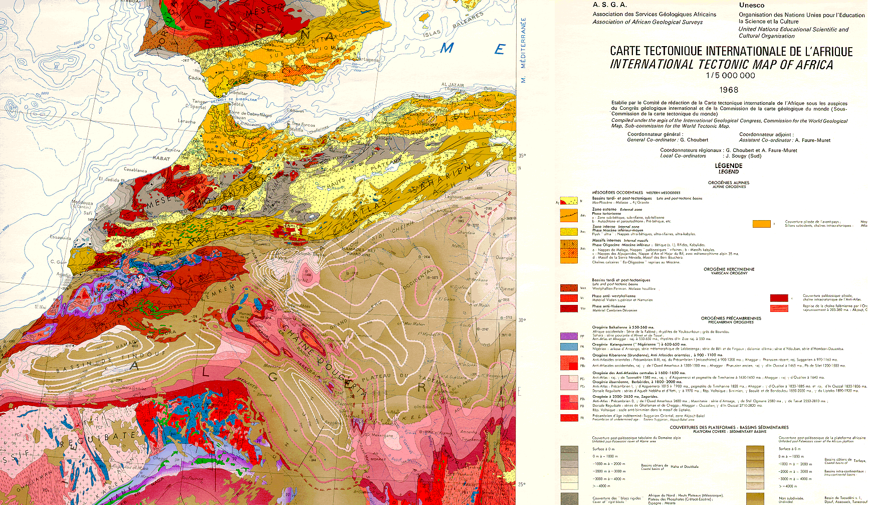 1:5,000,000 International Tectonic Map of Africa.
(718KB GIF image)
Call Number: G 8201.C5 1964 .M6
German City Maps
German City Maps: World War II Era
These maps are in the catalog. Search the Libraries' Catalog by city name (or variants). Description: Maps of various cities in Germany and in some occupied countries. Maps show streets, major structures, and other features. These maps are now cataloged and can be located in the Libraries catalog. The link to German City Maps above lists what cities are available.